Keith Cowing’s Devon Island Journal – 11 July 2007: Heading North

Our flight today from Ottawa to Resolute Bay began with a little drama. Last night when Matt Reyes flew from Las Vegas to Philadelphia to Ottawa his luggage did not keep up with him. His tent and all of the gear he’d need for the arctic was somewhere in limbo. After multiple phone calls last night and more this morning we were more or less resigned to making the trip up with the hope that his luggage would soon catch up with him.
Then, at the last minute, someone from First Air (the airline we were getting on) came running to the gate with the news that his stuff had been found. With that good news we hoped on our initial flight from Ottawa to Iqualuit.
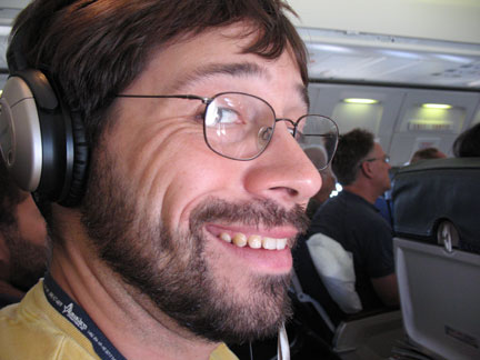
Matt Reyes is excited about having all of his luggage — Keith Cowing
We met the group of K10 rover operators heading up to Devon Island from the Intelligent Robotics Group at NASA Ames Research Center. They were just as sleep deprived as Matt and I were.
The first leg of what would eventually be a 10-hour trip was rather uneventful – not unlike any medium range commuter flight I have taken dozens of times. Sleeping made it even shorter.
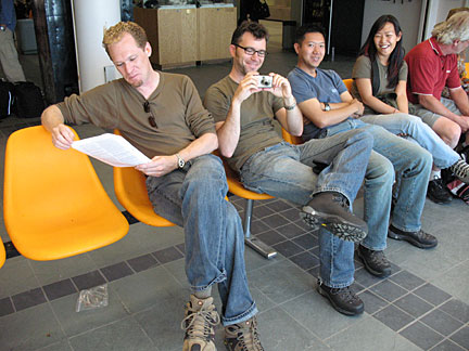
The K10 Rover Team: (L-R) Mark Allen, Matt Deans, Vinh To, and Susan Lee, waiting to begin their arctic journey in Ottawa — Keith Cowing
I went to sleep flying over forests. I awoke flying over ice and barren ground. Ah, the arctic!
We had two-hour layover in Iqualuit. With nothing else to do, Matt and I went out for a walk toward downtown Iqualuit.
Arrival at Iqaluit — Keith Cowing
Terminal at Iqaluit Airport. It looks like it landed here under its own propulsion. — Keith Cowing
Given the uncertainty about boarding times, we did not stray too far. At one point I was actually able to use my cell phone to call home. That was a surprise. The last time I was here (in 2003) you had to wait in line to use one of the two pay phones inside the terminal. Progress.
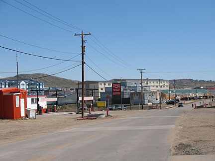
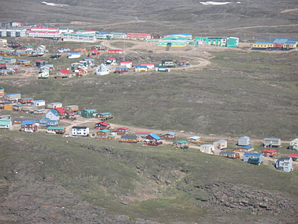
Downtown Iqaluit — Keith Cowing
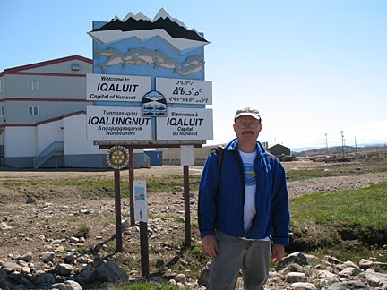
Keith Cowing standing in front of the main welcome sign for Iqaluit – Keith Cowing
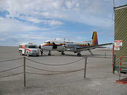
Eventually we boarded a more cramped Hawker Siddeley HS-748 turboprop (built in the late 1950’s) for the trip that would eventually drop us at Resolute Bay. Matt and I were soon glad that we both had the Bose noise canceling headphones. Without them our brains would have been turned to mush.
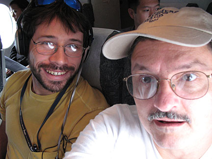
Matt Reyes and Keith Cowing enjoying their ride on a Hawker Siddeley HS-748 turboprop — Keith Cowing
On the way we stopped for fuel at Hall Beach and Nanisivik. Both are small communities with a very small population and a large gravel runway. Give the dryness and good weather, our plane’s tires really created a torrent of dust and gravel as we took off.
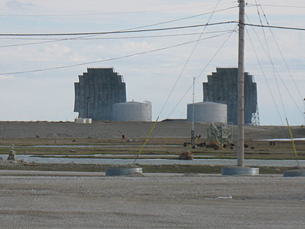
The airport terminal at Hall Beach – 1950 era DEW Line radar dishes. — Keith Cowing
While we refueled at Hall Beach we stood around looking at the scenery. There isn’t much – with the exception of two huge, old, Distant Early Warning (DEW) radar installations. These radar systems were established back in the 1950’s and were the reason why Hall Beach was created. Now they are abandoned.
Refueling our Hawker Siddeley at Hall Beach — Keith Cowing

The terminal at Nanisivik Airport – Keith Cowing
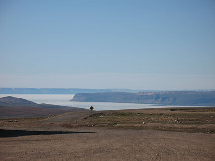
Later, when we landed at Nanisivik, there was much more to look at. Perched up on a rise above the town and the bay we got a nice vista to look at while our plane was being refueled. Nanisivik was founded to service a large lead mine nearby. Now, that mine is being shut down the town is apparently going away as well.
A curious road sign at Nanisivik airport
The funniest thing I saw was a lone traffic sign warning of a winding road heading away from the landing strip. It was odd to see this since you could clearly see the road winding away. Yet there were no signs warning vehicular traffic of incoming airplanes.
Soon enough we were in the air again for the hour or so trip to Cornwallis Island – and Resolute Bay. Eventually, we began our descent into Resolute airport.
As we were heading in, Matt picked up a map on the back of the airline magazine and pointed to the large island to our right.
“Is that …?” he asked
“Yes, That’s Devon”. I answered. A large grin appeared on Matt’s face.
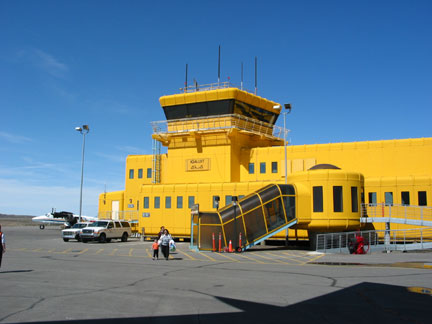
Resolute Airport — Keith Cowing
We landed without incident and departed the plane. After a short walk to Resolute Airport’s one gate terminal we were greeted by Haughton-Mars Project Principal Investigator Pascal Lee and his dog “Ping Pong”.
After our luggage appeared we stopped off at the Polar Continental Shelf Project Facility. This facility is run by the Canadian government organization that runs logistics that supports our project and others around the Canadian arctic.
We needed to drop off any luggage here at PCSP that we would not need overnight so as to simplify cargo loading tomorrow morning. Since I was going to be part of the first team of four going over tomorrow morning I left most of my stuff behind.

The Co-op where I stayed while in Resolute Bay — Keith Cowing
We then headed for the Tadjaat Co-op Hotel – Qausuittuq Inns North. The Co-op is a classic example of permafrost construction – everything is up off of the ground – and all surfaces are heavily insulated. Every room is nice and comfortable with curtains that are designed to block 95% of the outside sunlight. Usually you stay two to a room. The place is empty right now so we each got our own room.
After dinner at the Co-op, Pascal took us on a tour of the major attractions in Resolute. We saw a dog team in training, wreckage from a plane crash decades ago, a fascinating Inuit settlement that is being restored – complete with whalebone beams (which were once covered by animal hides)
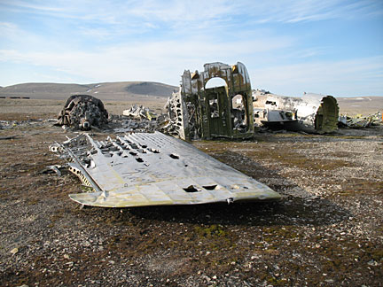
Debris from an airplane crash decades ago just outside Resolute Bay — Keith Cowing

An ancient Inuit dwelling just outside Resolute Bay currently under reconstruction — Keith Cowing
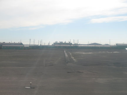
When we returned we took a tour of downtown Resolute Bay (population 200). The downtown tour takes about 3 minutes – 6 minutes if you turn around and drive back through town.
After doing some website updates in my room, I went to sleep around midnight local time. Of course, were it not for the thick curtains in my room, I’d be bombarded with bright sunlight. Not that this mattered since I would have still fallen asleep quickly. More on that in a day or so when I am on Devon Island.
About Devon Island, The Haughton-Mars Project, and the Mars Institute
The Haughton-Mars Project (HMP) is an international interdisciplinary field research project centered on the scientific study of the Haughton impact structure and surrounding terrain, Devon Island, high arctic, viewed as a terrestrial analog for Mars. The rocky polar desert setting, geologic features and biological attributes of the site offer unique insights into the possible evolution of Mars – in particular the history of water and of past climates on Mars, the effects of impacts on Earth and on other planets, and the possibilities and limits of life in extreme environments. In parallel with its science program, the HMP supports an exploration program aimed at developing new technologies, strategies, humans factors experience, and field-based operational know-how key to planning the future exploration of the Moon, Mars and other planets by robots and humans. The HMP managed jointly by the Mars Institute and by the SETI Institute.