Offworld Biology: Processing Microbe Samples Inside The Microgravity Science Glovebox
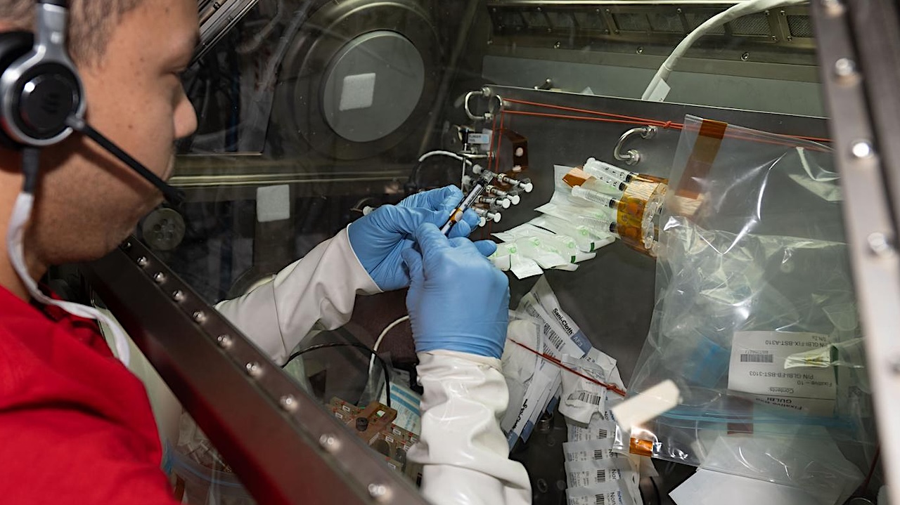
iss074e0319944 (Feb. 21, 2026) — Credit: ESA/Sophie Adenot larger image
NASA astronaut and Expedition 74 Flight Engineer Chris Williams processes microbe samples inside the Destiny laboratory module’s Microgravity Science Glovebox aboard the International Space Station.
Williams was investigating the use of ultraviolet light as a method to disinfect spacecraft surfaces, inhibit microbial growth, and protect both crew health and space hardware.
Astrobiology