Revealing the Internal Structure of Mars-Analog Glaciers From Drone-Based Radar Sounding
Debris-covered glaciers (DCGs) at the mid latitudes of Mars preserve ice accumulated in multiple episodes of high obliquity during the Amazonian age. The englacial debris layers formed during interglacials are of interest for astrobiological and paleoclimate studies. However, retrieving detailed internal stratigraphy with NASA’s Shallow Radar (SHARAD, 15-25 MHz remains challenging.
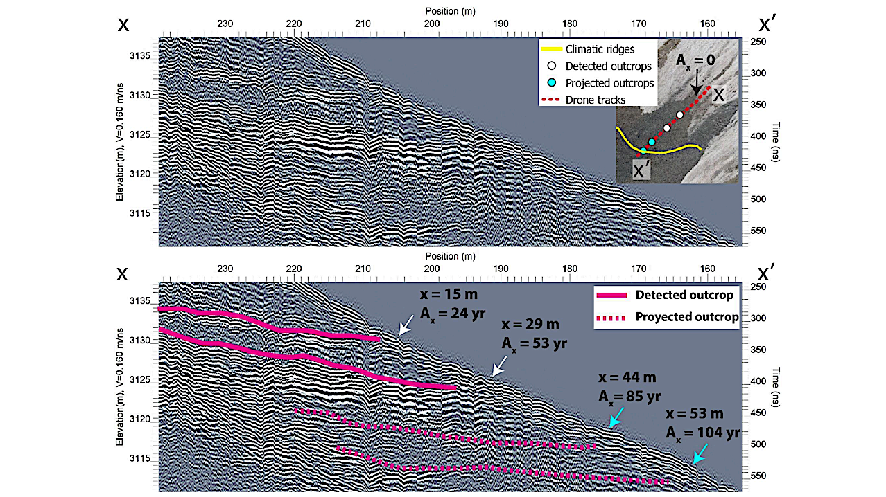
Following the success of the Ingenuity Mars helicopter, drones have emerged as a promising platform for future geophysical surveys on Mars. In prior work on terrestrial analogs for Martian DCGs, we showed that a drone-based ground penetrating radar (DGPR) can effectively resolve glacier bulk depth and supraglacial debris thickness—a critical parameter for in-situ resource utilization (ISRU) of water].
In this study, we evaluated the DGPR’s capability to map the near-surface layering in the cirque of Galena Creek Rock Glacier, a terrestrial DCG previously surveyed with surface-based GPR. By combining the DGPR subsurface mapping with repeated drone photogrammetry, we calculated the age of englacial debris layers and analyzed the relationship of their outcropping locations with traverse-flow surface ridges.
Revealing the Internal Structure of Mars-Analog Glaciers From Drone-Based Radar Sounding, Roberto J. Aguilar et al., 56th LPSC (2025)
Astrobiology, Astrogeology,