Orbital Biosignature Survey: Lake Erie Algal Bloom
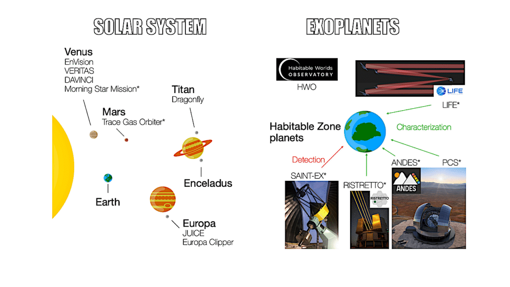
Editor’s note: with the future advent of powerful telescopes that may be able to resolve habitable worlds in images composed of a few pixels, large biological phenomena such as algal bloom on our home world could be visible. The more we know about observing and characterizing them on Earth the better prepared we’ll be to search for them on other worlds as new, more powerful exoplanet observational tools come online.
Algal blooms have become a common occurrence on Lake Erie, as much a part of summer at the lake as island-hopping, scenic cruises, and roller coasters. In 2024, a bloom of blue-green algae began forming in the lake’s western basin on June 24—the earliest that a bloom has been identified by NOAA since the agency began tracking them in 2002. It was still present in early September. Bloom season can last into October, with its duration depending on the frequency of wind events that mix lake waters in the fall.
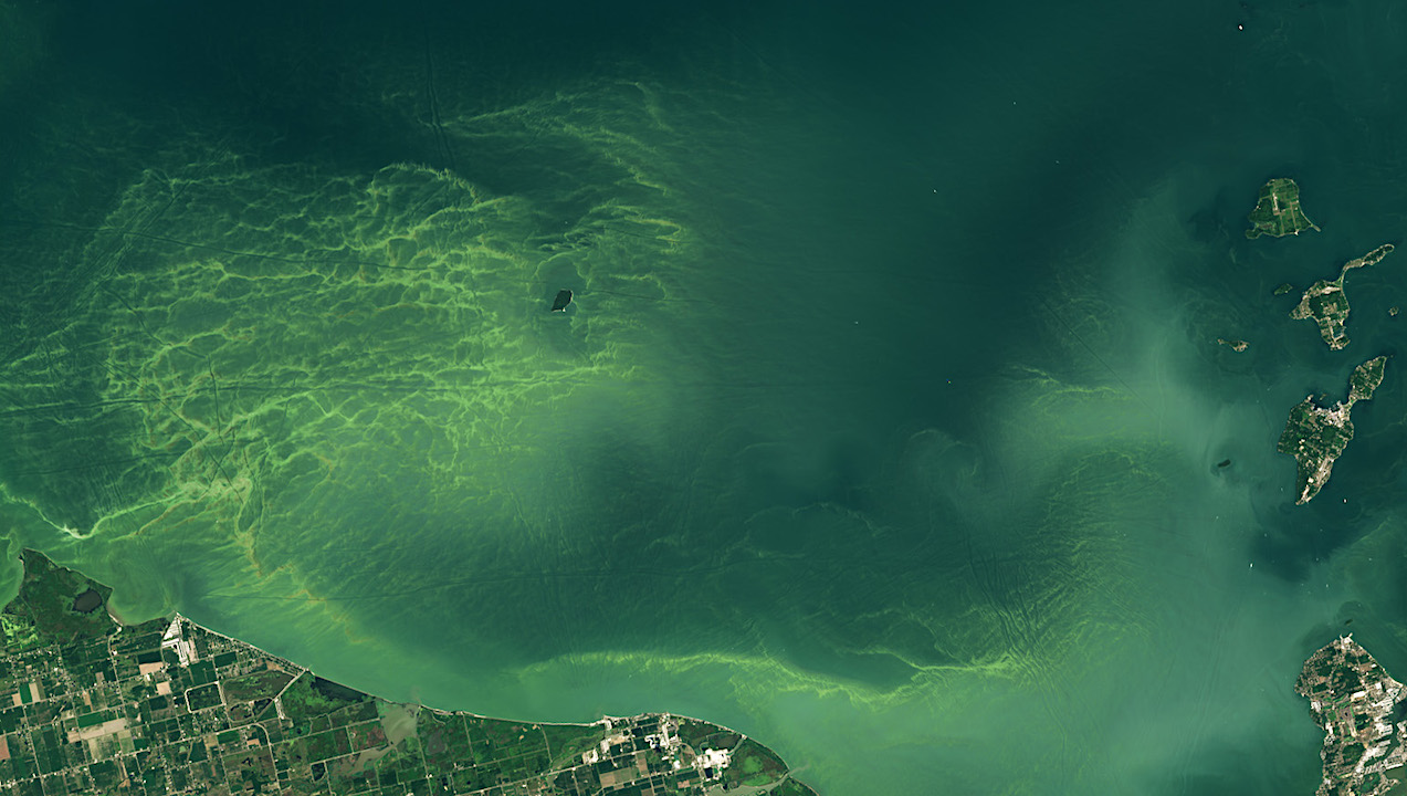
When the OLI-2 (Operational Land Imager-2) on Landsat 9 acquired this image on August 13, the bloom covered approximately 320 square miles (830 square kilometers). Since that date, which was the last time Landsat satellites got a clear look at this part of the lake, the bloom would more than double in area to the season’s likely largest extent of 660 square miles (1,700 square kilometers) on August 22.
Phytoplankton blooms carry implications for the lake ecosystem, human health, the local economy, and even municipal water supplies. The dominant organism in this bloom, a Microcystis cyanobacteria, produces the toxin microcystin, which can cause liver damage, numbness, dizziness, and vomiting. NOAA’s Great Lakes Environmental Research Laboratory measured toxins at concentrations above the recreational limit the week of August 12. The agency noted that toxins can be concentrated in scums, advising that people and their pets stay out of the water near scums.
NOAA and its research partners had forecasted a moderate to above-moderate harmful algal bloom (HAB) in western Lake Erie this summer. Blooms are classified based on their biomass, and a moderate-severity bloom will produce noticeable areas of scum. However, the agency noted, a bloom’s size does not necessarily correlate with its toxicity.
“Nutrient input from the Maumee River is the dominant driver of HAB variability from year to year,” said Brice Grunert, a professor in the department of Biological, Geological, and Environmental Sciences at Cleveland State University. Other factors such as temperature, mixing of the water column, and water movement also influence the extent and duration of blooms, he said. Precipitation can increase the load of nutrients such as nitrogen and phosphorous in runoff to the lake, and warmer, more stratified water can amplify blooms. In 2024, the bloom followed a period of record April rainfall and an intense heatwave, according to news reports.
Satellite imagery plays an important role in helping scientists understand the nuances of phytoplankton blooms, which in turn can aid those charged with monitoring and forecasting the events. Grunert has been working in Lake Erie’s western basin for the past three years to better understand phosphorous cycles within the lake. His team is investigating how satellite imagery, combined with data from sediment sampling and chemical tracers, relates to the amount of algae-producing phosphorous in the water column.
He and other scientists studying aquatic ecosystems will soon have a new tool at their disposal in the form of the OCI (Ocean Color Instrument) aboard NASA’s PACE (Plankton, Aerosol, Cloud, ocean Ecosystem) satellite. This instrument measures waterbodies in hundreds of wavelengths across a spectrum of ultraviolet, visible, and near-infrared light. When fully calibrated, the data will enable scientists to track the distribution of phytoplankton and—for the first time from space—identify which communities of these organisms are present on daily, global scales.
Despite the presence of the word “ocean” in the mission title, PACE also opens new lines of inquiry in the freshwater realm. “There are a lot of interesting questions that can be addressed using PACE imagery in the Great Lakes,” Grunert said. For example, hyperspectral data will be able to reveal phytoplankton pigments that could previously only be estimated with the limited number of spectral bands, he said. And a more detailed perspective of blooms over space and time is expected to help scientists decipher how HABs in Lake Erie develop and why cyanobacterial blooms in Lake Superior are starting to occur. “This unlocks a whole new level of information that can be used to describe the unique and changing ecosystems and biogeochemistry within the Great Lakes,” he said.
Grunert is currently working on a PACE Validation Science Team project, taking field measurements in parallel to observations being collected by PACE’s OCI. These include water-surface color and the optical properties of phytoplankton, sediment, and other substances in the water column.
NASA Earth Observatory image by Wanmei Liang, using Landsat data from the U.S. Geological Survey. Story by Lindsey Doermann.
Astrobiology


