Synthetic Aperture Radar Backscatter Is Influenced By Bubbles At The Ice/Water Interface Of An Antarctic Lake
Additional information on the long term study of Lake Untersee and other regions of Antarctica by Astrobiologist Dale Andersen
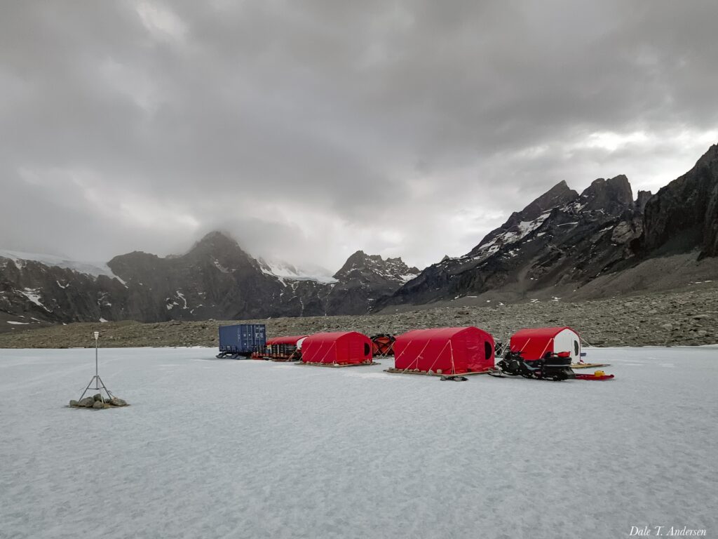
The perennial ice-covers of Antarctic lakes are an important feature that influence the biogeochemistry of the water column and the benthic microbial ecosystem. The thickness of perennial ice covers, typically in the 3–6 m range, is maintained by the equilibrium between water freezing onto the bottom of the ice cover and its ablation at the surface.
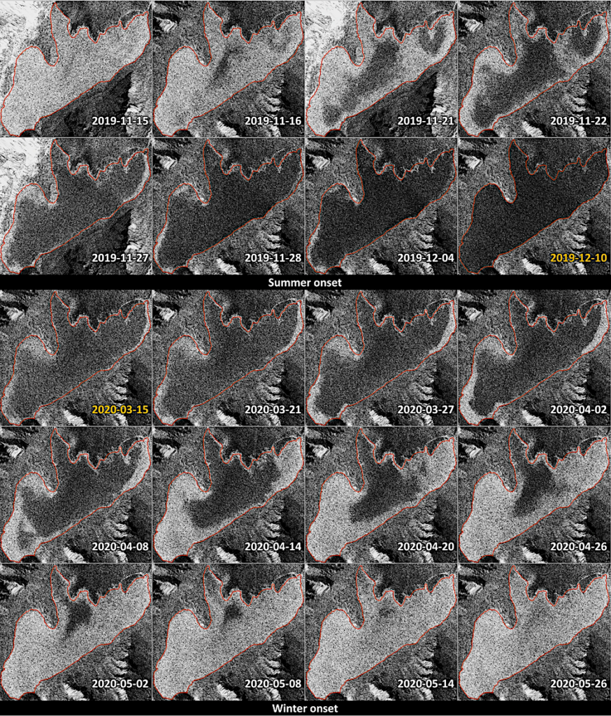
Examples of the spatio-temporal patterns of SAR backscatter intensity change that are regularly observed over Lake Untersee between seasons during the 4 years of available SAR imagery. Tiled imagery is Sentinel-1 SLC IW (courtesy of ESA Copernicus program) backscatter intensity as dB, processed and created using CATALYST Professional.
The water column of a perennially ice-covered lake (PICL) is often supersaturated in gases, with the saturation level mainly determined by the thickness of the ice cover and its effect on hydrostatic pressure. As water freezes to the bottom of the ice cover, the gases are exsolved, and the gas supersaturation level increases in the boundary layer. Bubble nucleation begins when the total pressure of dissolved gases equals the local hydrostatic pressure at the ice/water interface. The gas bubbles then become included in the accreting ice and are eventually released into the atmosphere from the ablation of the ice cover.
The thickness and bubble content of the ice covers are thus critical to the benthic phototrophic ecosystem as they affect the optical properties (scattering and absorption caused by bubbles and sediments) of the ice cover and, therefore, the amount of light reaching the water column7. Therefore, knowledge about the spatial and temporal changes in internal optical properties of the perennial ice covers, including bubbles, in Antarctica is important to assess the state of the aquatic ecosystems and global environments.

Frames extracted from video footage captured under the ice cover at sites BH02, BH03, and BH7 on 22 and 25 November 2022. Note, the scale bar is only accurate for features at the top of the frames. Photos taken by AG using a submersible video camera attached to a rope.
Synthetic aperture radar (SAR) imagery is commonly used to infer lake ice conditions. Early studies recognized that variations in dissolved gas content in the water column may affect the formation of bubbles at the ice/water interface and impact backscatter intensities.
However, studies largely attributed the high backscatter over seasonally ice-covered lakes to the high dielectric contrast at the ice/water interface and a double bounce interaction between vertically oriented tubular bubbles within the ice. Subsequent studies have used these scattering mechanisms to infer lake ice phenology (freeze-up and break-up) from changes in backscatter intensity time series from dense stacks of SAR imagery.
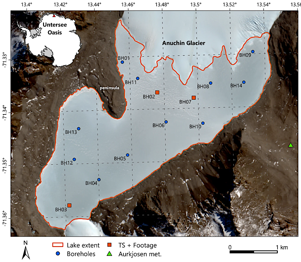
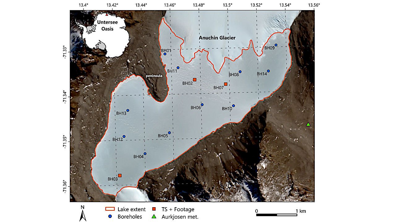
Location map showing the Lake Untersee ice cover outline (orange line), the location of boreholes (BH) where water depth and ice thickness were measured (blue circle), the borehole locations used for backscatter time series analysis and where ice/water interface footage was captured (orange square), and the meteorological station in the Aurkjosen Valley just east of the lake (green triangle). The inset map shows the location of the Untersee Oasis relative to continent of Antarctica. Background is Sentinel-2 optical imagery acquired on 12 January 2018, courtesy of ESA Copernicus program. Map generated using ArcGIS Pro.
Adam Gaudreau, Denis Lacelle & Dale T. Andersen
Synthetic aperture radar backscatter is influenced by bubbles at the ice/water interface of an Antarctic lake, Nature Communications Earth & Environment (open access)
Astrobiology


