New Global Topographic Map Unveils Unique Distortions On Enceladus
A team of scientists has produced the first complete and comprehensive global topographic map of Saturn’s active icy moon Enceladus, revealing that it is even more distorted than previously thought. In an article published in the journal Icarus, USRA’s Paul M. Schenk of the Lunar and Planetary Institute and William B. McKinnon of Washington University in St. Louis show that this small ocean world is being deformed by internal processes well outside the areas of active venting at the South Pole.
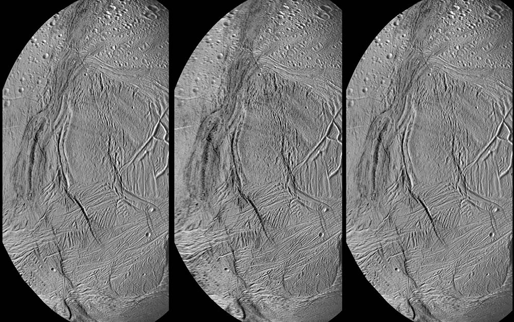
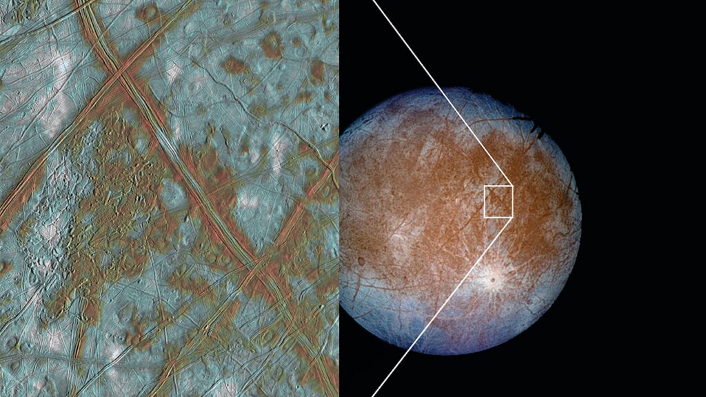
Stereo image of Enceladus showing deformed terrains, impact craters, a 1.5-kilometer-high ridge (at center left) and a large deep basin (upper left). Resolution of images is 350 meters/pixel. The images were acquired by reflected light from Saturn. In this format, the scene can be viewed in cross-eyed or wall-eyed stereo (use the center-left or center-right combination). Credit: Paul Schenk/USRA-Lunar and Planetary Institute.
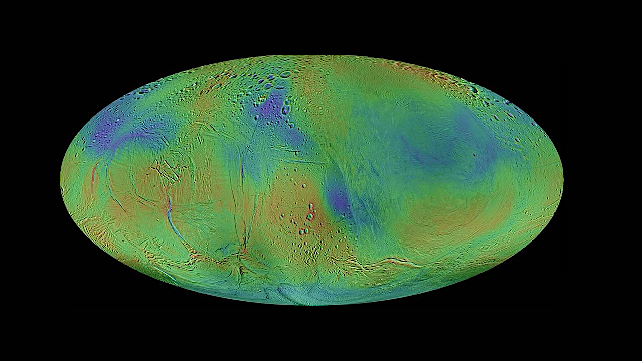
The most prominent features in the new map are oval depressions that are 100 kilometers (~62 miles) wide and up to 1.5 kilometers (~1 mile) deep. In 2009, the authors published a preliminary topographic map of less than half the surface of Enceladus that showed several of these depressions. However, their new globally complete data have revealed that these large oval basins are mostly on one side of Enceladus and that a larger more complex depression now can be seen on the other hemisphere.
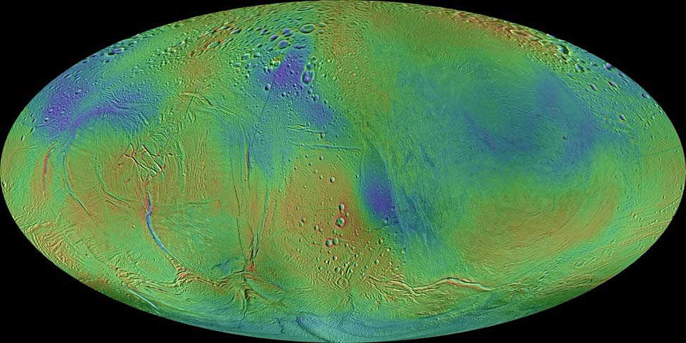
Mollweide map projection of new topographic map of Enceladus. Colors are used to show topographic range, with reds being high and blues being low. Enceladus’ global triaxial figure has been subtracted to bring out the features shown. Credit: Paul Schenk/USRA-Lunar and Planetary Institute.
“Some of these basins are simple ovals but others have more complex shapes that correlate with geologic features,” says Dr. Schenk, lead author of this study and a specialist in cartography of icy moons, including their topography, surface color, and morphology. This correlation suggests that the ice shell floating on Enceladus’ ocean is not uniform in its thickness or properties. “We don’t know the exact origin of these basins, but their global distribution revealed by our new map is rather similar to patterns predicted for hydrothermal plumes that could be venting from the rocky core of Enceladus,” says Dr. Schenk. If true, plumes of buoyant hot water venting from such a core into Enceladus’ global ocean could rise and impinge on the ice shell floating on the ocean. Such impingement could trigger thinning and perhaps localized melting of the ice shell, causing the surface directly above to sink—forming the basins.
“Whether such hydrothermal activity actually occurs will require a return to Enceladus to determine how this strange moon is getting rid of its excess heat,” says coauthor Dr. William McKinnon of Washington University in St. Louis.
The new topographic map of Enceladus is derived from almost 100 stereo image pairs of the surface acquired during the NASA Cassini mission, which were used to create topographic maps that were then integrated to produce the global topographic map product.
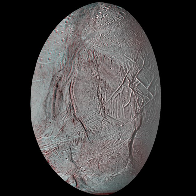
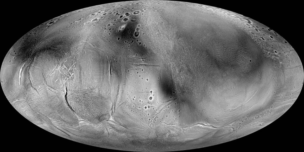
Red-blue anaglyph version of stereo image of Enceladus above. Red-blue glasses required for viewing. Credit: Paul Schenk/USRA-Lunar and Planetary Institute.
Perhaps the biggest surprise from the new topographic map is that Enceladus is distorted in the north-south direction relative to what its shape would be if it were a stress-free, perfectly uniform body. Enceladus is observed to be somewhat pear-shaped. It is low in the south polar region, higher at mid-southern latitudes, lower again at mid-northern latitudes, and high again at the north pole. These distortions are on the order of 350 to 400 meters in amplitude. These distortions in Enceladus’ shape provide unique new insights into the ongoing internal dynamics of this ocean world, which will be the subject of future investigation.
For more information, visit https://www.sciencedirect.com/science/article/abs/pii/S0019103523004062
Astrobiology