Saildrone Surveyor Away Team Completes Uncrewed Alaska Ocean Mapping Mission
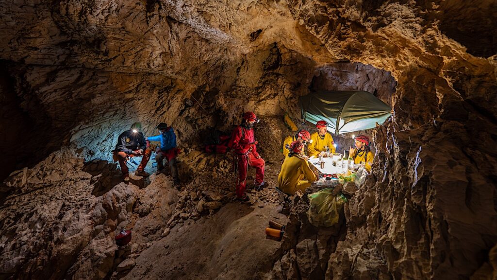
Editor’s note: As we plan to use robotic probes to explore worlds in our solar system with oceans, missions that explore Earth’s oceans can serve as important pathfinders.
The Saildrone Surveyor, the world’s largest uncrewed ocean mapping vehicle, has completed a months-long survey around Alaska’s Aleutian Islands and off the coast of California as part of a multi-agency public-private partnership funded by the National Oceanic and Atmospheric Administration (NOAA) and the Bureau of Ocean Energy Management (BOEM) to address ocean exploration gaps in remote areas with uncrewed surface vehicles (USVs).
The United States Exclusive Economic Zone (EEZ), stretching from the coast to 200 nautical miles from shore, is one of the largest in the world, but it is largely still unmapped, unobserved, and unexplored. In terms of area, Alaska is by far the least mapped region of the US EEZ.
Saildrone Surveyor SD 1200 departed Saildrone HQ in Alameda, CA, to sail across the North Pacific to the survey area in July 2022. Between August and October, it mapped 16,254 square kilometers (4,739 square nautical miles) of unknown seafloor around the Aleutian Islands over 52 days. During the mission, the Surveyor also carried technology from the Monterey Bay Aquarium Research Institute (MBARI) to sample environmental DNA (eDNA). Outfitted with the Environmental Sample Processor (ESP)—a groundbreaking “lab in a can”—the Surveyor was able to collect important clues about marine biodiversity and ocean health from the genetic “fingerprints” left behind by marine life.
Severe weather is the norm in the Aleutian region, but the Surveyor continued to collect high-quality data even in 35-knot winds and wave swells over 5 meters (16 feet)—conditions that would have proved too challenging for most crewed survey vessels.
The Surveyor is a force multiplier to the existing ocean exploration paradigm and can be combined with a traditional survey ship to cost-effectively broaden operations: Collected data will be used to optimize dive targets during upcoming expeditions on NOAA Ship Okeanos Explorer.
“Every American, in one way or another, depends on the ocean—from protein from fish to feed animals or humans, to deep-sea cables that make the internet possible. The only way the US can maximize our ocean resources is to understand what’s there. This mission is the first step to mapping the seafloor of key regions in Aleutian waters in high resolution. The beauty of the Surveyor is getting that initial exploration step done faster, cheaper, and without as much staff,” said Dr. Aurora Elmore, Cooperative Institute Manager at NOAA Ocean Exploration.
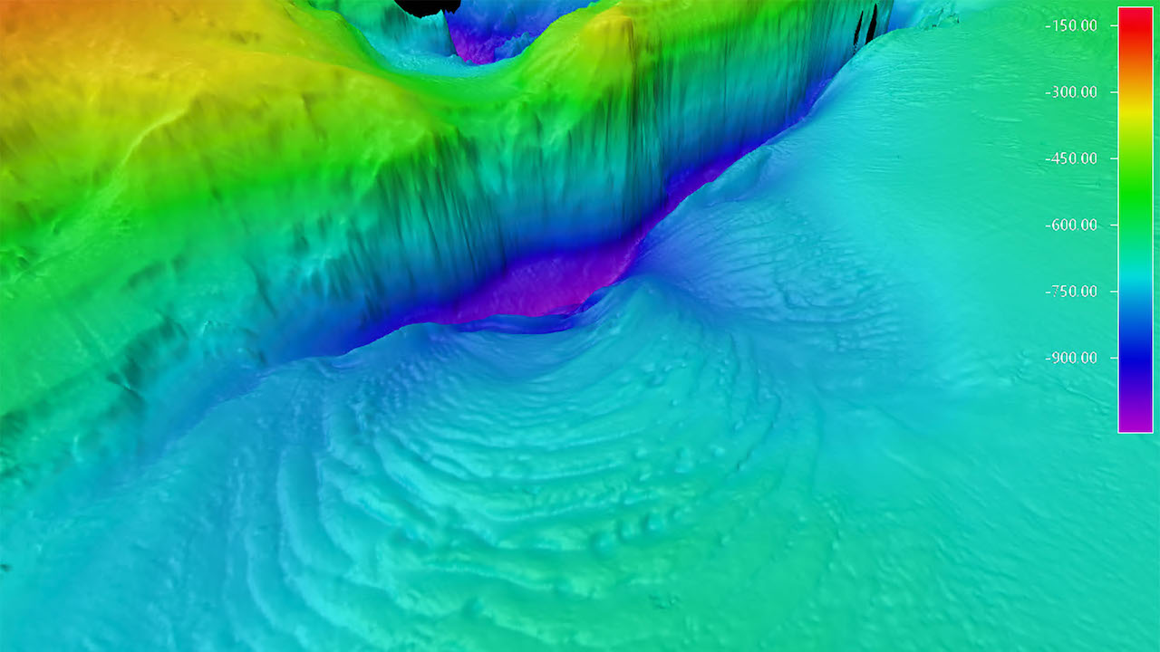
During the second half of the mission off the coast of California, the Surveyor mapped an additional 29,720 square kilometers (8,665 square nautical miles) of the US EEZ and discovered a previously unknown seamount standing approximately 1,000 meters (3,200 feet) high. Identifying such seamounts improves our understanding of the physical processes of the ocean and identifies areas needing further exploration as unique habitats.
“Surveyor brings a new and exciting capability for ocean exploration and mapping. Mapping in the Aleutians is not trivial, and the conditions there can be austere any time of year. The Surveyor weathered the storms, collected high-resolution bathymetry, and put no humans at risk. This mission proves that long-endurance USVs provide a viable option to achieve the goals of the National Ocean Mapping, Exploration, and Characterization Strategy. This is the future of ocean mapping,” said Brian Connon, Saildrone VP of Ocean Mapping.
The project was operationally managed through NOAA’s Ocean Exploration Cooperative Institute (OECI), including its partner institution, the University of New Hampshire. Its mission was to gather data on several large, unexplored areas off the Aleutian chain identified as high priority for NOAA, BOEM, the US Geological Survey, and the broader federal Interagency Working Group on Ocean Exploration and Characterization.
The data collected around the Aleutian Islands will be publicly available through NOAA’s National Centers for Environmental Information once post-processing has been completed by the Center for Coastal and Ocean Mapping at the University of New Hampshire.
SD 1200 is the first of Saildrone’s Surveyor class vehicles. An additional four Surveyor-class ocean mapping vehicles will be built by Austal USA in Mobile, AL, this year to meet increasing global demand for uncrewed survey vehicles. Meet the Saildrone team at US Hydro in Mobile, AL, March 12 – 16.
About Saildrone
Navigating an ocean of data. Delivering a world of possibility.
Saildrone provides comprehensive turnkey data solutions for maritime security, ocean mapping, and ocean data. The company enables real-time access to critical data from any ocean on earth and uses proprietary software applications and machine learning technology to transform that data into actionable insights and intelligence. Saildrone’s fleet of uncrewed surface vehicles (USVs), powered by renewable wind and solar power, are designed to make ocean intelligence cost-effective at scale with a minimum carbon footprint. Saildrone vehicles operate 24/7/365, without the need for a crewed support vehicle, and have sailed over 900,000 nautical miles from the Arctic to the Antarctic and spent more than 24,000 days at sea in the harshest ocean conditions on the planet. https://www.saildrone.com/
About NOAA Ocean Exploration
NOAA Ocean Exploration and the Bureau of Ocean Energy Management are the primary sponsors of this work. NOAA Ocean Exploration is dedicated to exploring the unknown ocean, unlocking its potential through scientific discovery, technological advancements, partnerships, and data delivery. We are leading national efforts to fill gaps in our basic understanding of the marine environment, providing critical ocean data, information, and awareness needed to strengthen the economy, health, and security of the United States and the world. https://oceanexplorer.noaa.gov/
About the Center for Coastal and Ocean Mapping/NOAA Joint Hydrographic Center
The University of New Hampshire’s Center for Coastal and Ocean Mapping/NOAA Joint Hydrographic Center (CCOM/JHC) is a NOAA-supported national center of expertise in the fields of coastal hydrography and advanced coastal ocean mapping. Their main objectives are to foster a new generation of hydrographers and ocean mapping scientists, and develop and evaluate a wide range of state-of-the-art hydrographic and ocean mapping technologies and applications. https://ccom.unh.edu/
About the Bureau of Ocean Energy Management
BOEM’s mission is to manage development of the U.S. Outer Continental Shelf energy and mineral resources in an environmentally and economically responsible way. BOEM develops, funds and manages rigorous scientific research studies to inform its policy decisions on offshore energy and mineral resource development. https://www.boem.gov/
About MBARI
MBARI (Monterey Bay Aquarium Research Institute) is a private non-profit oceanographic research center, founded by David Packard in 1987. The mission of MBARI is to advance marine science and technology to understand a changing ocean. www.mbari.org
Astrobiology