Mars South Pole: Suspected Underground Lake Is Probably A Layer Of Rock And Dust
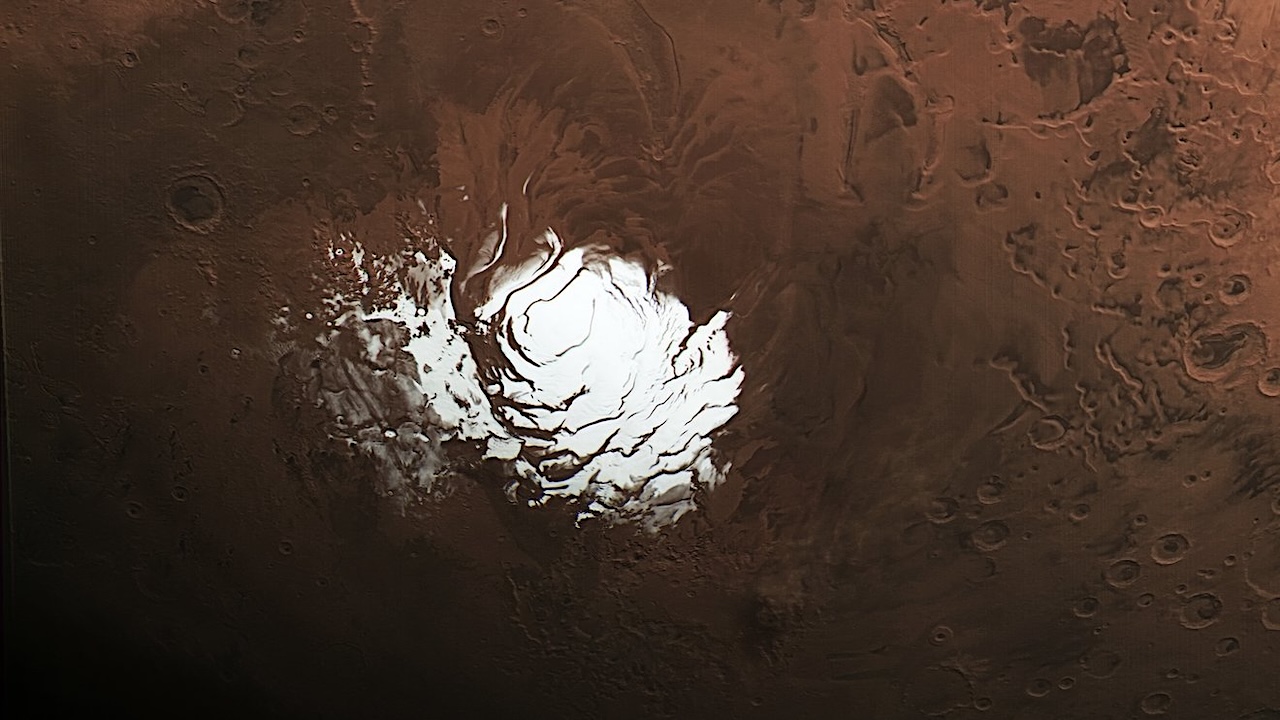
NASA’s Mars Reconnaissance Orbiter (MRO) has revisited and raised new questions about a mysterious feature buried beneath thousands of feet of ice at the Red Planet’s south pole. In a recent study, researchers conclude from data obtained using an innovative radar technique that an area on Mars suspected of being an underground lake is more likely to be a layer of rock and dust.
The 2018 discovery of the suspected lake set off a flurry of scientific activity, as water is closely linked with life in the solar system. While the latest findings indicate this feature is not a lake below the Martian surface, it does suggest that the same radar technique could be used to check for subsurface resources elsewhere on Mars, supporting future explorers.
The paper, published in Geophysical Research Letters on Nov. 17, was led by two of MRO’s Shallow Radar (SHARAD) instrument scientists, Gareth Morgan and Than Putzig, who are based at the Planetary Science Institute in Tucson, Arizona, and Lakewood, Colorado, respectively.
The observations were made by MRO with a special maneuver that rolls the spacecraft 120 degrees. Doing so enhances the power of SHARAD, enabling the radar’s signal to penetrate deeper underground and provide a clearer image of the subsurface. These “very large rolls” have proved so effective that scientists are eager to use them at previously observed sites where buried ice might exist.
Morgan, Putzig, and fellow SHARAD team members had made multiple unsuccessful attempts to observe the area suspected of hosting a buried lake. Then the scientists partnered with the spacecraft’s operations team at NASA’s Jet Propulsion Laboratory in Southern California, which leads the mission, to develop the very large roll capability.
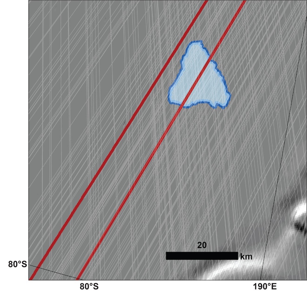
High Reflectivity Zone (HRZ) region of the South Polar Layered Deposits (SPLD) showing SHARAD coverage at roll angles less than 30° (white lines) and the ground tracks of the two SHARAD Very Large Roll observations (red lines). Inset shows the location of the HRZ within the SPLD. Background is MOLA hillshade. — NASA
Because the radar’s antenna is at the back of MRO, the orbiter’s body obstructs its view and weakens the instrument’s sensitivity. After considerable work, engineers at JPL and Lockheed Martin Space in Littleton, Colorado, which built the spacecraft and supports its operations, developed commands for a 120-degree roll — a technique that requires careful planning to keep the spacecraft safe — to direct more of SHARAD’s signal at the surface.
Bright signal
On May 26, SHARAD performed a very large roll to finally pick up the signal in the target area, which spans about 12.5 miles (20 kilometers) and is buried under a slab of water ice almost 1 mile (1,500 meters) thick.
When a radar signal bounces off underground layers, the strength of its reflection depends on what the subsurface is made of. Most materials let the signal slip through or absorb it, making the return faint. Liquid water is special in that it produces a very reflective surface, sending back a very strong signal (imagine pointing a flashlight at a mirror).
That’s the kind of signal that was spotted from this area in 2018 by a team working with the Mars Advanced Radar for Subsurface and Ionospheric Sounding (MARSIS) instrument aboard the ESA (European Space Agency) Mars Express orbiter. To explain how such a body of water could remain liquid under all that ice, scientists have hypothesized it could be a briny lake, since high salt content can lower water’s freezing temperature.
“We’ve been observing this area with SHARAD for almost 20 years without seeing anything from those depths,” said Putzig. But once MRO achieved a very large roll over the precise area, the team was able to look much deeper. And rather than the bright signal MARSIS received, SHARAD detected a faint one. A different very-large-roll observation of an adjacent area didn’t detect a signal at all, suggesting something unique is causing a quirky radar signal at the exact spot MARSIS saw a signal.
“The lake hypothesis generated lots of creative work, which is exactly what exciting scientific discoveries are supposed to do,” said Morgan. “And while this new data won’t settle the debate, it makes it very hard to support the idea of a liquid water lake.”
Alternative explanations
Mars’ south pole has an ice cap sitting atop heavily cratered terrain, and most radar images of the area below the ice show lots of peaks and valleys. Morgan and Putzig said it’s possible that the bright signal MARSIS detected here may just be a rare smooth area — an ancient lava flow, for example.
Both scientists are excited to use the very large roll technique to reexamine other scientifically interesting regions of Mars. One such place is Medusae Fossae, a sprawling geologic formation on Mars’ equator that produces little radar return. While some scientists have suggested it’s composed of layers of volcanic ash, others have suggested the layers may include heaps of ice deep within.
“If it’s ice, that means there’s lots of water resources near the Martian equator, where you’d want to send humans,” said Putzig. “Because the equator is exposed to more sunlight, it’s warmer and ideal for astronauts to live and work.”
More about MRO
NASA’s Jet Propulsion Laboratory in Southern California manages MRO for the agency’s Science Mission Directorate in Washington as part of NASA’s Mars Exploration Program portfolio. Lockheed Martin Space in Denver built MRO and supports its operations. SHARAD was provided to the MRO mission by the Italian Space Agency (ASI).
High Frequency Radar Perspective of Putative Subglacial Liquid Water on Mars, Geophysical Research Letters, (open access)
Astrobiology


