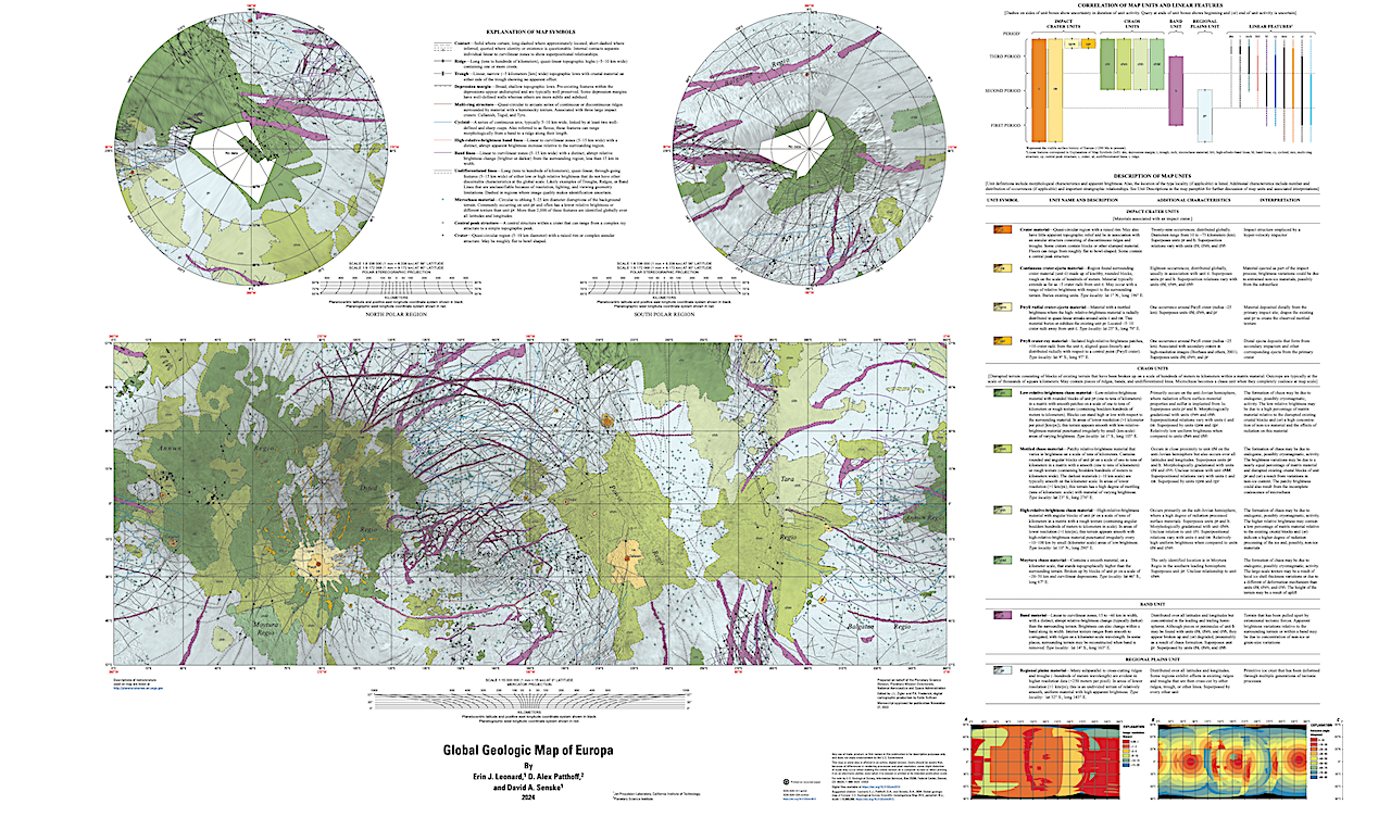
New USGS Global Geologic Map of Europa Is Now Online
Discovered by Galileo Galilei more than 400 years ago and imaged in detail by the Voyager 2 Galileo spacecraft, Jupiter’s icy moon Europa has been a source of intrigue.
A range of science investigations indicate that it contains the key ingredients for habitability, notably energy, chemistry, and liquid water. Europa’s surface is geologically complex and, based on the dearth of impact craters, interpreted to be as young as ~60 Ma. The array of geologic features that characterize the surface include extensive ridged plains, regions of broad disruption termed chaotic terrain, long, quasi-linear ridges that span thousands of kilometers, and bands as much as 60 kilometers wide and that extend 100s of kilometers.
These features, along with other geophysical measurements, indicate the presence of a global briny liquid water ocean beneath the ice shell. It was not until the arrival of the Galileo spacecraft in 1995 that the true nature and level of complexity of the surface was revealed. Although image data returned by Galileo provided insight into the structure of a variety of regions, the entire satellite has yet to be observed at a regional scale (less than 250 meters per pixel) and the detailed geologic nature of much of its surface remains a mystery.
Establishing the global context of the distribution and timing of Europan geologic units forms a basis to understand regional and local scale processes, serves as a tool for the planning of future missions, and most of all is essential to gaining insight into the potential habitability of this icy world.
Link to various map versions and data, USGS
Astrobiology


