Ice World Exploration: A Massive Underwater Antarctic Canyon Has Been Discovered On Earth
Editor’s note: it goes without saying that the exploration of the oceans of Enceladus, Europa, Ganymede and other worlds will guide the development of these future missions. As you read through this release from the Australian Antarctic Program that we still have vast regions of our own planet that remain unexplored – and that sometimes big discoveries happen almost by accident. Our missions to map other ocean worlds will need to be ready for that too.
A massive underwater canyon has been discovered in Antarctica by acousticians on board icebreaker RSV Nuyina.
The canyon was discovered when wild weather forced resupply work at Casey research station to be temporarily suspended.
Rather than sit and wait for the weather to pass, voyage leadership decided to use the time to map the seafloor at the nearby Adams Glacier, about 70 km away.
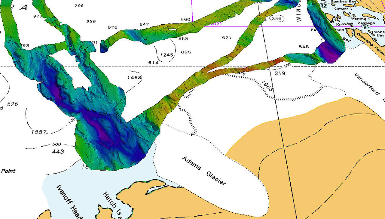
What they found was remarkable – a 2100 metre-deep, 9000 metre-wide canyon, extending more than 25 nautical miles (more than 46 kilometres) off the glacier front.
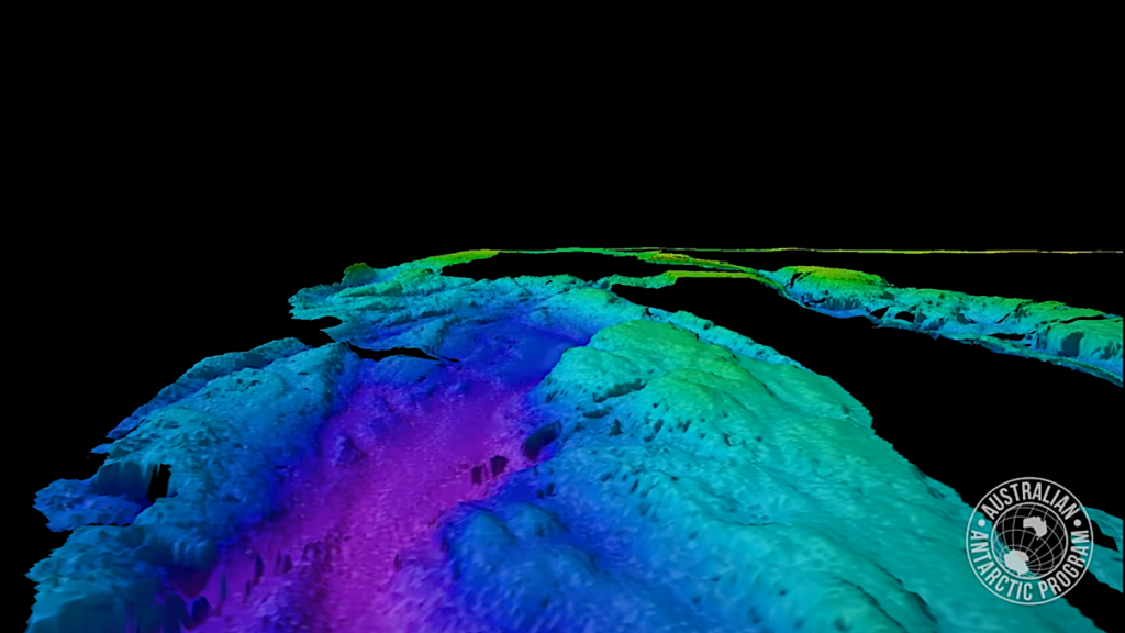
Adams Glacier canyon fly through video
For senior acoustician Alison Herbert, and science systems engineer Tom Rushton Brumby, it’s the second time they’ve discovered an impressive Antarctic seafloor feature using the ship’s acoustic instruments.
“This latest mapping adds to our initial discovery two years ago, on Nuyina’s maiden voyage to Casey, when we mapped the nearby Vanderford Canyon, which is 2200 metres deep, 2000 metres wide and at least 55 kilometres-long,” Ms Herbert said.
“Nuyina’s multibeam echosounder gives us much greater capability for detailed mapping of the seafloor than we’ve ever had before, and these two new discoveries suggest there will be many more to come.”
The acoustics team initially discovered just the southern tip of the canyon before the ship had to return to Casey for cargo operations.
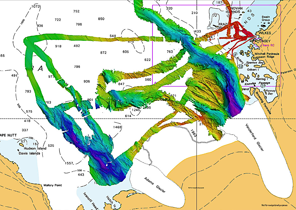
Acousticians mapped a canyon in front of Adams Glacier earlier this year, while the Vanderford Canyon was mapped from RSV Nuyina on her maiden voyage in 2021-22. Blue and purple colours indicate deep water. (Photo: AAD/hydrographic material reproduced with permission of The Australian Hydrographic Office © Commonwealth of Australia 2024)
Voyage Leader Keith Ashby said that, fortunately, bad weather enabled the return of the vessel to the area a few days later, when further observations were taken in very difficult conditions.
“Four metre seas and 50 knot winds put a hold on our resupply operations at Casey, so we decided to ride out the weather in open water, allowing our acoustics team to conduct about 15 hours of mapping in front of Adams Glacier,” Mr Ashby said.
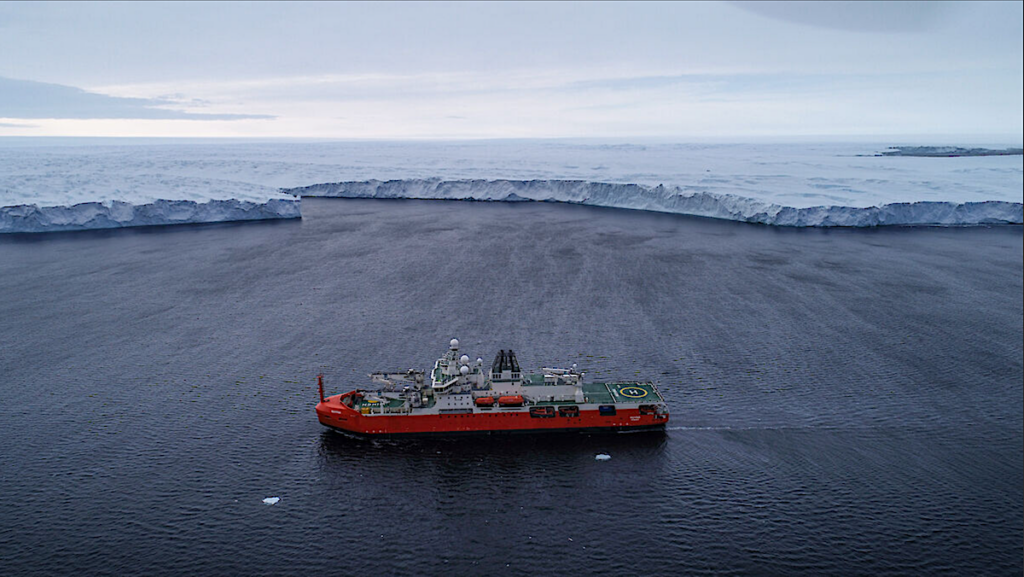
RSV Nuyina off the Vanderford Glacier in 2021. (Photo: Pete Harmsen)
“Then on our way back to Australia we made another fleeting visit to fill in some remaining gaps, resulting in a comprehensive picture of this deep, glacial trough.
“As the voyage was primarily for station resupply, the fact that we had any opportunity to complete some seabed mapping was really pleasing. To discover a substantial feature like a large canyon was genuinely exciting.”
The Nuyina’s multibeam echosounder works by sending out pings of sound in a fan-shape beneath the ship and ‘listens’ to the returning echoes to build a picture of the seafloor.
“I always find it fun, and almost mesmerising, to make a rainbow road of the seabed ping by ping,” Ms Herbert said.
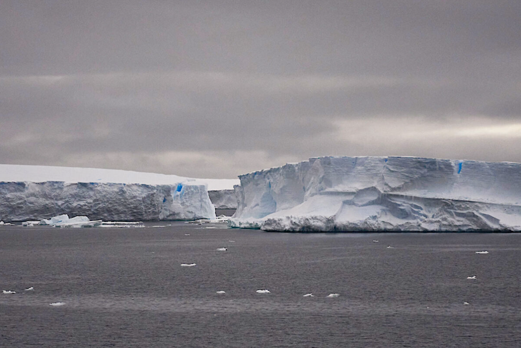
Icebergs at the front of Adams Glacier. (Photo: Keith Deverell)
Among other things, maps of the seabed generated using multibeam echosounder data provide insights into the geological and glacial history of the area and allow scientists to identify areas for further study.
RSV Nuyina technology manager, Lloyd Symons, said the ship had risen to the challenge it was designed for.
“One of the specific objectives in building RSV Nuyina was to provide Australia with the capability to map the Antarctic continental shelf,” Mr Symons said.
“Discovery and mapping of these deep glacial canyons is key to developing better models of the interaction between the Antarctic ice sheet and the ocean. This is just the beginning.”
Astrobiology,