Ancient Landscape Discovered Beneath The East Antarctic Ice Sheet
Editor’s note: of particular interest to Astrobiology mission planners are the ice-covered worlds in our solar system – Enceladus, Europa, Ganymede, Mimas, Titan, etc. and the probability that they have vast oceans beneath their surfaces. As we seek to penetrate the outer surface, what sorts of geology will we find underneath? Studies in Earth’s polar region can help us develop the tools to study these icy worlds from space, on their surfaces, and one day, beneath their outer surfaces.
_____________
We’re part of an international research team that has discovered an ancient landscape that has lain hidden beneath the East Antarctic Ice Sheet for millions of years.
The researchers, led by Durham and Newcastle universities, used satellite data and radio-echo sounding techniques to map a 32,000 km2 area of land underneath the vast ice sheet.
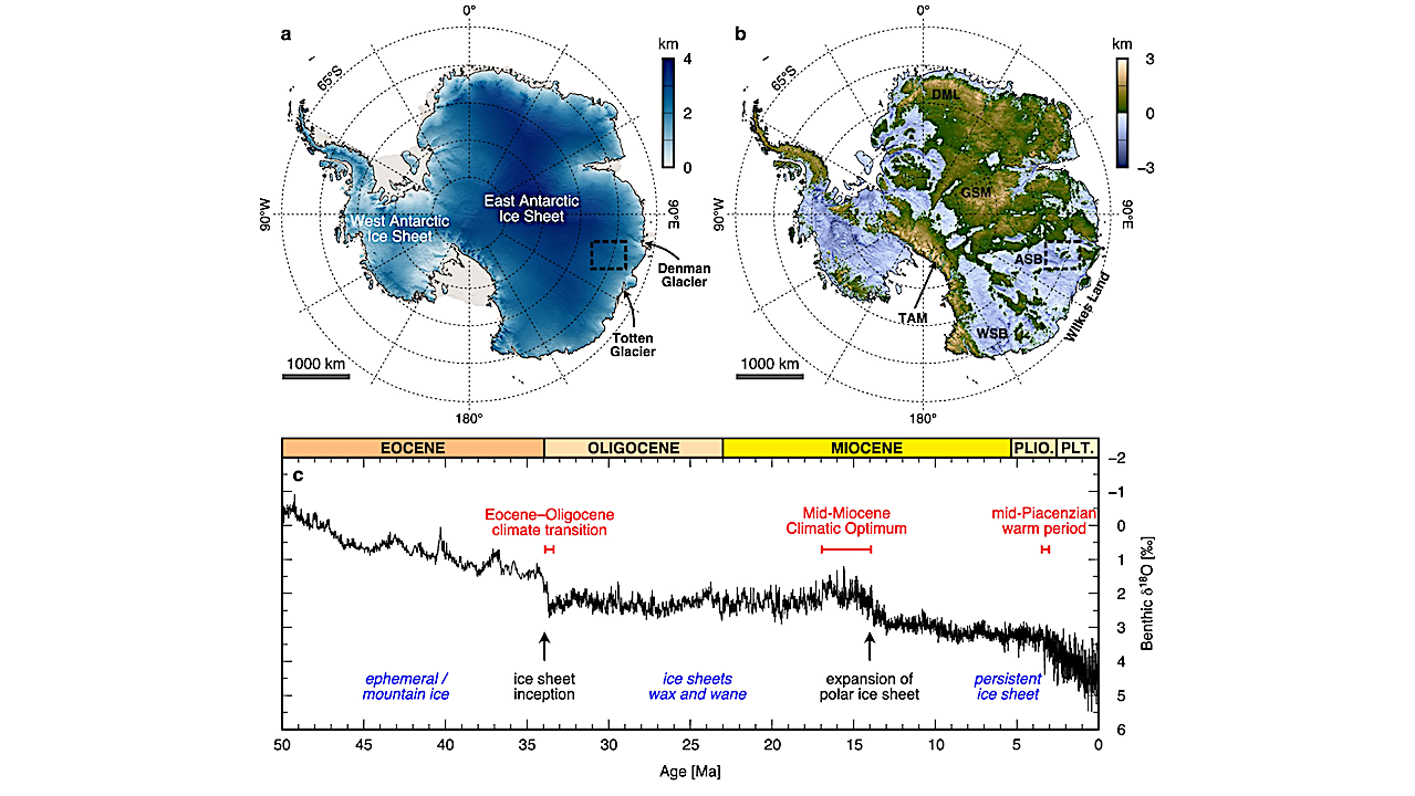
They discovered a landscape that appears to have been formed by rivers at least 14 million years ago and possibly even before the initial growth of the East Antarctic ice around 34 million years ago.
This newly discovered landscape consists of ancient valleys and ridges, similar in size-and-scale to the glacially-modified landscape of North Wales, UK.
It tells us important information about the early, and long-term, history of the East Antarctic Ice Sheet, as well as helping us to understand how it might evolve in response to future climate change.
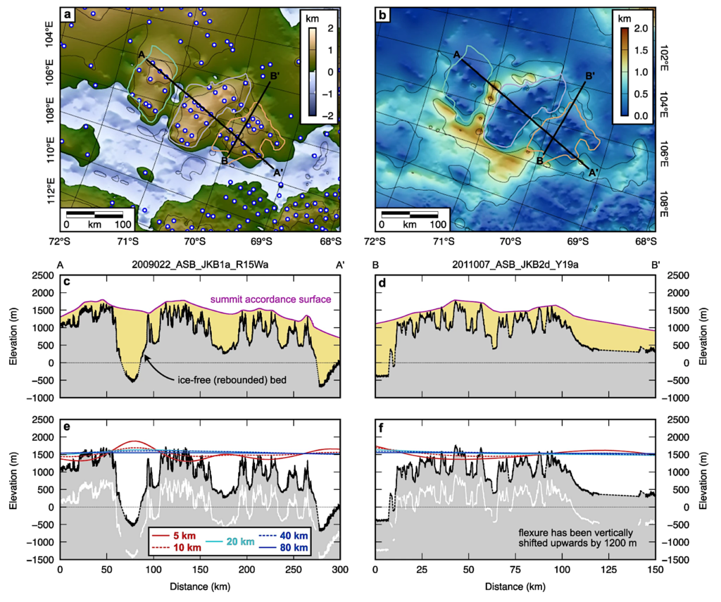
a BedMachine v.3 bed topography64 isostatically adjusted for the removal of the modern ice sheet load using a heterogeneous Te model45,70. White and blue circles mark topographic peaks used to estimate the distribution of valley and trough erosion. b Estimated erosion distribution, calculated by differencing the ice-free topography from a smooth accordant surface interpolated between the peaks shown in panel (a). c Erosion estimate along profile A–A’. The thickness of eroded material is shaded in yellow. Note that dashed lines indicate regions of the bed that are not imaged by RES data. d Same as panel (c) but for profile B–B’. Profile locations are shown in panels (a) and (b). e Computed flexural response to erosional unloading along profile A–A’ for five Te values. To aid visual comparison between the calculated flexure patterns and the tilt of the highland surfaces, the flexure has been vertically shifted upwards by 1200 m. The white line shows in situ bed elevation beneath the modern East Antarctic Ice Sheet. f Same as panel (e) but for profile B–B’. All elevations are relative to present-day global mean sea level. – Science
Building knowledge
The discovery builds on previous work by this team who, in collaboration with other researchers, have mapped out hidden mountain ranges, canyon systems and lakes beneath the ice in Antarctica.
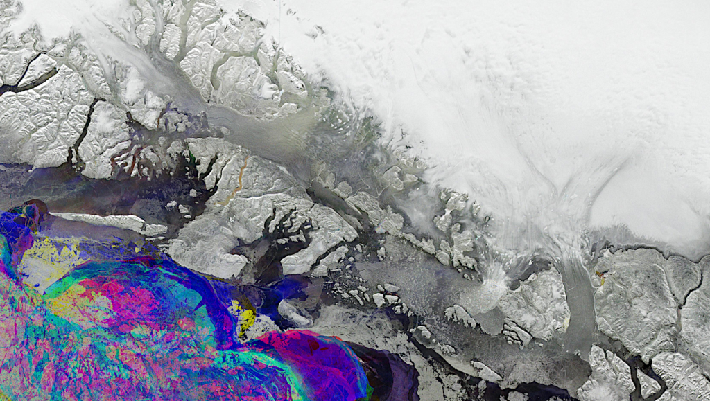
Although the landscape beneath the ice sheet is not visible to the naked eye, satellite images captured over the region show small undulations of the ice sheet’s surface that provide clues about what lies beneath.
In a few places, the landscape’s existence has been confirmed by using radio-echo sounding from planes to see through the ice and map the shape of the land beneath the ice sheet.
The research team proposes it is likely that there will be other, as yet undiscovered, ancient landscapes hidden beneath the East Antarctic Ice Sheet.
Their study has been published in the journal Nature Communications.
Top images show the plane and equipment used to conduct a partial survey of Antarctica during the ICECAP data gathering project, courtesy of ICECAP. Central image shows how the landscape of Antarctica would appear if the ice were lifted away, courtesy of Stewart Jamieson.
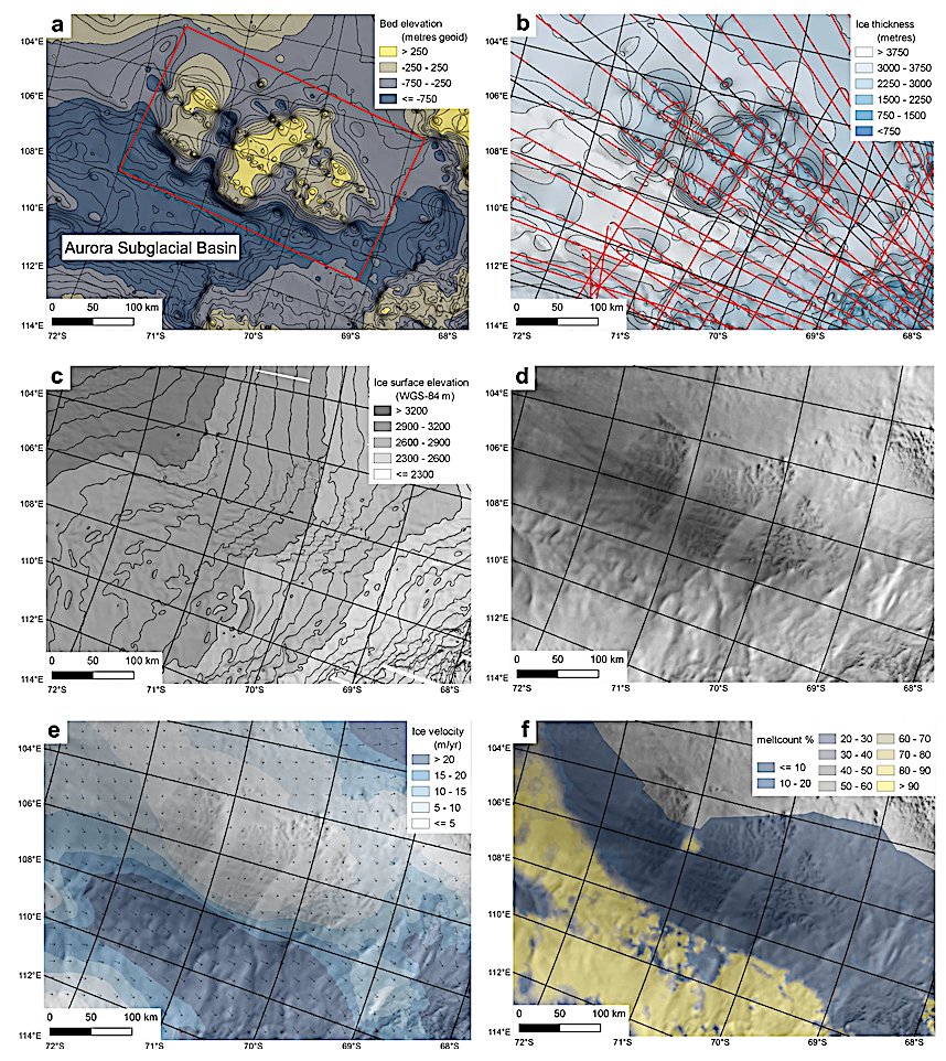
a BedMachine version 3 bed elevation64, contours (black) in 250 m increments. Bed dataset is transparent and underlain by a hillshade of the same dataset. Extent of Fig. 3a shown by red box; b BedMachine version 3 ice thickness64. Black lines are radar profiles, with red parts showing where bed was picked. Ice thickness contours (black) are in 125 m increments. Ice thickness dataset is transparent and underlain by a hillshade of the same dataset; c Ice surface elevation68, contours (black) in 50 m increments. Ice surface dataset is transparent and underlain by a hillshade of the same dataset; d RADARSAT image mosaic of Antarctic ice surface morphology42; e ice sheet velocity41; f Basal melting47 identified as a percentage of 500 ensemble members recording basal melt. Backdrop imagery for (e) and (f) is a RADARSAT image mosaic of Antarctica42. — Science
Find out more
The research was led by Professor Stewart Jamieson in our Department of Geography. Read more about his work here.
You can read the full paper ‘An ancient river landscape preserved beneath the East Antarctic Ice Sheet’ in Nature Communications here. We are a world-leading centre of geographic education, ranked joint 14th in the QS World University Rankings by Subject 2023.
Our success as a department is a measure of the open, inclusive environment we foster for students. To be a member of Durham Geography is to be welcomed by a community that wants you to succeed and creates an environment to make it happen.
An ancient river landscape preserved beneath the East Antarctic Ice Sheet, Nature (open access)
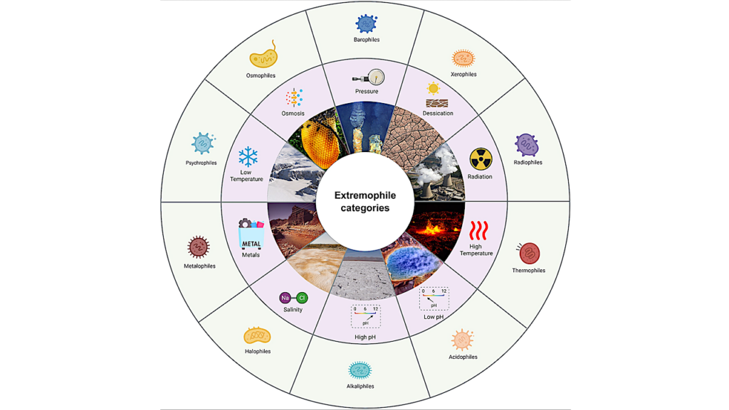
Astrobiology