3D Models Of Mars To Aid Rosalind Franklin Rover In Its Quest For Ancient Life

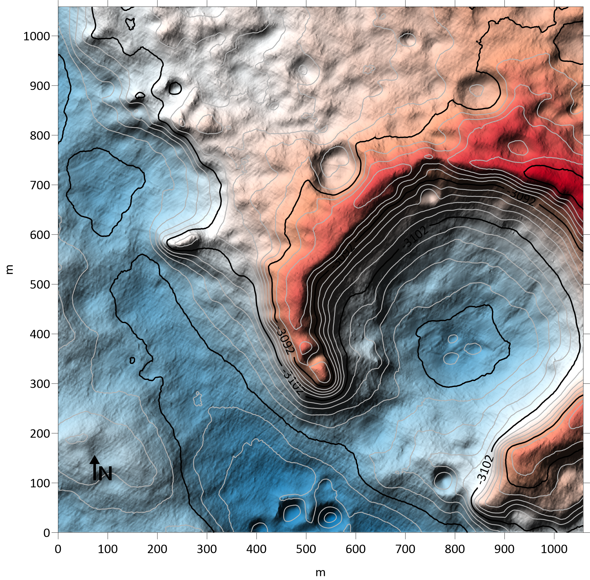
Scientists at TU Dortmund University have generated high-accuracy 3D models of terrain within the landing ellipse of the ESA/Roscosmos ExoMars rover, Rosalind Franklin. The Digital Terrain Models (DTMs) have a resolution of about 25 cm per pixel and will help scientists to understand the geography and geological characteristics of the region and to plan the path of the rover around the site.
To increase the accuracy of the models, the team has developed an innovative technique that integrates atmospheric data into the digitally-generated scenes. The models will be presented by Kay Wohlfarth at the EPSC-DPS Joint Meeting 2019 in Geneva on Monday 16 September.
The DTMs are based on high-resolution imagery of Mars from the HiRISE instrument on NASA’s Mars Reconnaissance Orbiter. HiRISE imagery has been widely applied to the classic stereo method of combining two images taken from slightly different angles to create a 3D picture of the landscape. However, conventional stereo techniques have limitations when applied to the featureless, homogeneous regions that characterise many dusty and sandy planetary surfaces, including the rover’s landing site.
Oxia Planum, the landing site chosen by ESA’s ExoMars Landing Site Selection Working Group for Rosalind Franklin, is comparatively flat to minimise the risk of a hard landing and to ensure accessibility for the rover to carry out its mission. The region contains clay minerals and structures from ancient river beds that may bear hints of past traces of life.
A video of the Digital Elevation Model of the landing site
To enhance the DTM, the team from TU Dortmund University has applied a technique called ‘Shape from Shading’ in which the intensity of reflected light in the image is translated into information on surface slopes. This slope data is integrated into the stereo imagery, giving an improved estimate of the 3D surface and achieving the best resolution possible in the reconstructed landscape.
Kay Wohlfarth explained: “With the technique, even small-scale details such as dune ripples inside craters and rough bedrock can be reproduced.”
Marcel Hess, first author of the study, said: “We have taken special care over the interaction between light and the Martian surface. Areas that are tilted towards the Sun appear brighter and areas that are facing away appear darker. Our approach uses a joint reflectance and atmospheric model that incorporates reflection by the surface as well as atmospheric effects that diffuse and scatter light.”
The Rosalind Franklin ExoMars rover will carry a suite of scientific instruments to analyse rocks and the surface environment at Oxia Planum. To look beneath the surface, it carries a drill that will retrieve samples and deliver them to an onboard laboratory designed to detect biosignatures, as well as instruments to probe the subsurface water content. The mission will launch in the summer of 2020 on a Russian Proton-M launcher and arrive at Mars in March 2021.


